The 6 Feb. 2023 earthquakes of eastern Turkiye were the most devastating in the region for the past century. Researchers from China University of Geosciences, US Geological Survey, and Middle East Technical University were on the scene one day after the quakes, and used drones and field surveys to make the most detailed maps of a major continental earthquake ever, so soon after major earthquakes.
Their paper, “Surface deformations of the 6 February 2023 earthquake sequence,” has been published in the journal Science.
The surface deformation, together with the geophysical data show that the rupture sequence started slowly on the Africa/Arabia plate boundary, and when the rupture hit the Arabia/Anatolia boundary, it exploded, like a bullet hitting a bomb, and activated the entire East Anatolian fault system, causing the vast destruction.
Lessons learned will help protect other communities in earthquake-prone areas in the future.
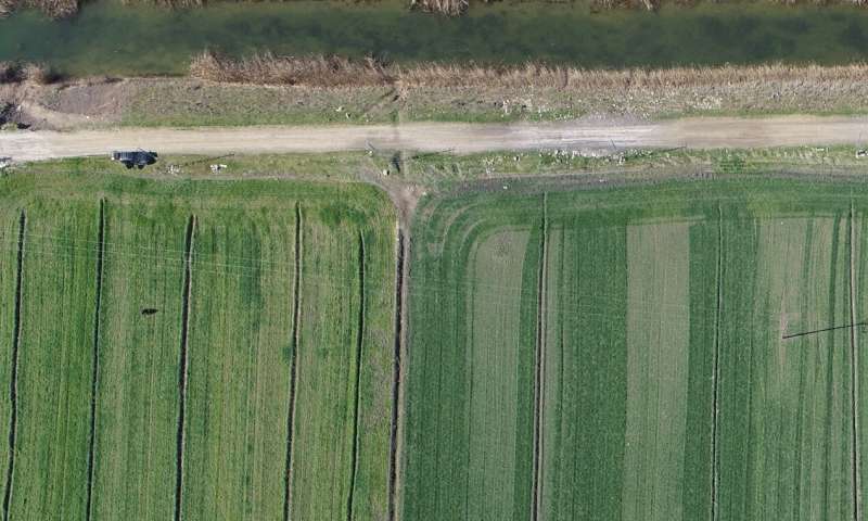
Drone image taken 30 days after the February 6th, 2023 Earthquake Sequence in eastern Türkiye. The activated transform plate boundary offset the upper 20 km of the crust, offsetting olive groves, fences, and even buildings in its path. © Jiannan Meng
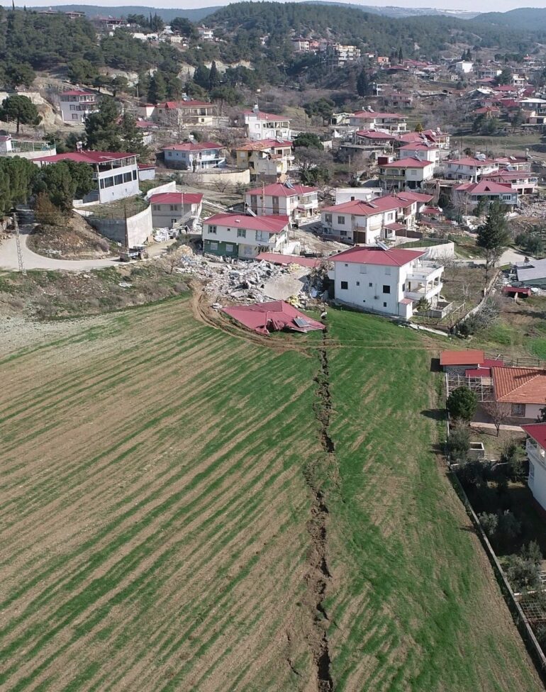
Glimpse of the ground rupture in farm land caused by February 6th , 2023 earthquake sequence in eastern Türkiye (Taken 32 days after the earthquakes, on March 10th ). The rupture continues from bottom left to the top right with the operator of the drone as a scale. Note this rupture formed in the middle of the basin without any preexisting surfaces and quickly vanished from rains human activities. © Jiannan Meng
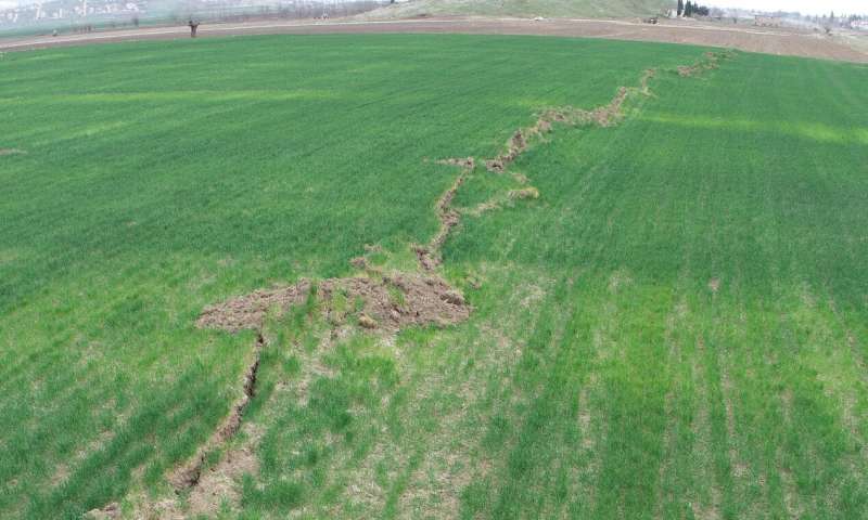
Drone image of ground offset of farm fields from the February 6 2023 earthquake sequence in eastern Türkiye, taken on February 24th 18 days after the earthquakes. The en echelon ground rupture features along the sinistral (top to the left) East Anatolian fault are clearly are clearly indicated by the offset rows of crops. This ephemeral surface deformation record was soon erased by rains and human activities. Black car at top left for scale. © Jiannan Meng
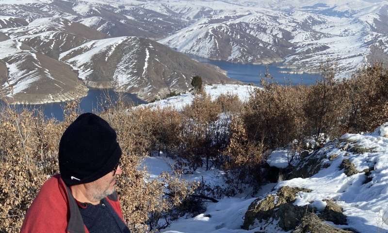
Searching for displacement features along the trace of the Çardak-Sürgü fault taken 12days after the devastating earthquakes of February 6th , 2023, in eastern Türkiye. The fault is marked by the recent scarp straddled by the geologist in the foreground. © Jiannan Meng


Strongly deformed railway track after the 2023 Turkey earthquake sequence, resulting from both ground shaking and liquefaction. The railway track has been moved around 2 meters horizontally. © Jiannan Meng
More information:
Jiannan Meng et al, Surface deformations of the 6 February 2023 earthquake sequence, eastern Türkiye, Science (2024). DOI: 10.1126/science.adj3770. www.science.org/doi/10.1126/science.adj3770
Provided by
China University of Geosciences
Citation:
Dramatic images of the 6 Feb. 2023 Turkiye earthquake scarps reveal details of motions of tectonic plates (2024, January 18)

