Hurricane Ian left an extraordinarily broad path of destruction across much of South Florida. That was evident in reports from the ground, but it also shows up in satellite data. Using a new method, our team of spatial and environmental analysts was able to quickly provide a rare big picture view of damage across the entire state.
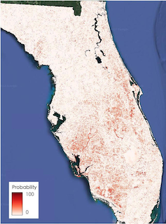
Satellite images and artificial intelligence reveal Hurricane Ian’s widespread damage. The dark areas have a high probability of damage.
Su Ye
By using satellite images from before the storm and real-time images from four satellite sensors, together with artificial intelligence, we created a disaster monitoring system that can map damage in 30-meter resolution and continuously update the data.
It’s a snapshot of what faster, more targeted disaster monitoring can look like in the future – and something that could eventually be deployed nationwide.
How artificial intellegence spots the damage
Satellites are already used to identify high-risk areas for floods, wildfires, landslides and other disasters, and to pinpoint the damage after these disasters. But most satelite-based disaster management approaches rely on visually assessing the latest images, one neighborhood at a time.
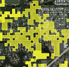
Our technique automatically compares pre-storm images with current satellite images to spot anomalies quickly over large areas. Those anomalies might be sand or water where that sand or water shouldn’t be, or heavily damaged roofs that don’t match their pre-storm appearance. Each area with a significant anomaly is flagged in yellow.
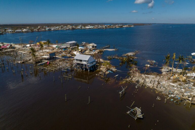
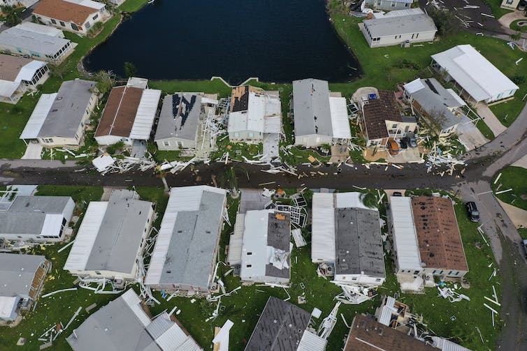
A dump truck works to repair a washed out road after Hurricane Ian hit Matlacha, Florida, on Oct. 3, 2022.
Ricardo Arduengo/AFP via Getty Images
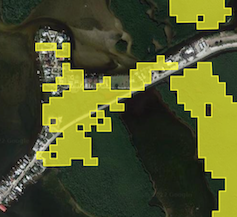
Damage detected in the same area of Matlacha as in the photo.
Su Ye
Five days after Ian lashed Florida, the map showed yellow alert polygons all over South Florida. We found that it could spot patches of damage with about 84% accuracy.
A natural disaster like a hurricane or tornado often leaves behind large areas of spectral change at the surface, meaning changes in how light reflects off whatever is there, such as houses, ground or water. Our algorithm compares the reflectance in models based on pre-storm images with reflectance after the storm.

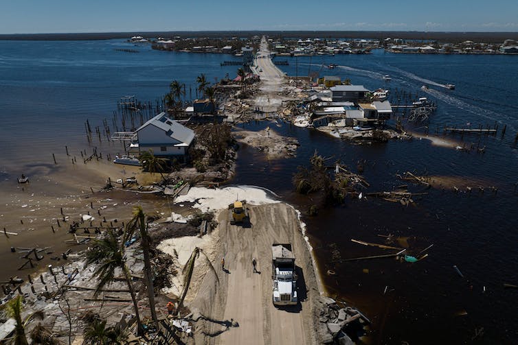
Punta Gorda, Florida, was hit by storm surge and high winds from Hurricane Ian.
Win McNamee/Getty Images
Damage in the same part of Punta Gorda shown in the photo.
Su Ye
The system spots both changes in physical properties of natural areas, such as changes in wetness or brightness, and the overall intensity of the change. An increase in brightness often is related to exposed sand or bare land due to hurricane damage.
Using a machine-learning model, we can use those images to predict disturbance probabilities, which…

