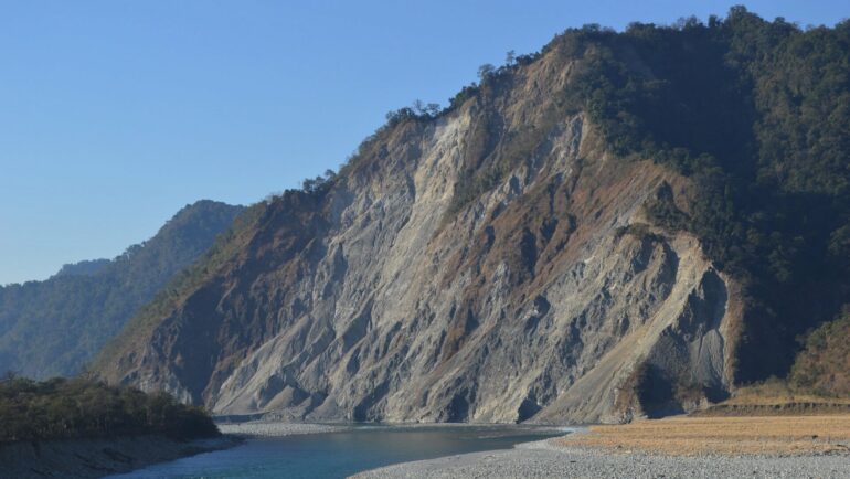
A new technique developed by UCLA geologists that uses artificial intelligence to better predict where and why landslides may occur could bolster efforts to protect lives and property in some of the world’s most disaster-prone areas.
The new method, described in a paper published in the journal Communications Earth & Environment, improves the accuracy and interpretability of AI-based machine-learning techniques, requires far less computing power and is more broadly applicable than traditional predictive models.
The approach would be particularly valuable in places like California, the researchers say, where drought, wildfires and earthquakes create the perfect recipe for landslide disasters and where the situation is to expected to get worse as climate change brings stronger and wetter storms.
Many factors influence where a landslide will occur, including the shape of the terrain, its slope and drainage areas, the material properties of soil and bedrock, and environmental conditions like climate, rainfall, hydrology and ground motion resulting from earthquakes. With so many variables, predicting when and where a chunk of earth is likely to lose its grip is as much an art as a science.
Geologists have traditionally estimated an area’s landslide risk by incorporating these factors into physical and statistical models. With enough data, such models can achieve reasonably accurate predictions, but physical models are time- and resource-intensive and can’t be applied over broad areas, while statistical models give little insight into how they assess various risk factors to arrive at their predictions.
Using artificial intelligence to predict landslides
In recent years, researchers have trained AI machine-learning models known as deep neural networks, or DNNs, to predict landslides. When fed reams of landslide-related variables and historical landslide information, these large, interconnected networks of algorithms can very quickly process and “learn” from this data to make highly accurate predictions.
Yet despite their advantages in processing time and learning power, as with statistical models, DNNs do not “show their work,” making it difficult for researchers to interpret their predictions and to know which causative factors to target in attempting to prevent possible landslides in the future.
“DNNs will deliver a percentage likelihood of a landslide that may be accurate, but we are unable to figure out why and which specific variables were most important in causing the landslide,” said Kevin Shao, a doctoral student in Earth, planetary and space sciences and co–first author of the journal paper.
The problem, said co–first author Khalid Youssef, a former student of biomedical engineering and postdoctoral researcher at UCLA, is that the various network layers of DNNs constantly feed into one another during the learning process, and untangling their analysis is impossible. The UCLA researchers’ new method aimed to address that.
“We sought to enable a clear separation of the results from the different data inputs, which would make the analysis far more useful in determining which factors are the most important contributors to natural disasters,” he said.
Youssef and Shao teamed with co–corresponding authors Seulgi Moon, a UCLA associate professor of Earth, planetary and space sciences, and Louis Bouchard, a UCLA professor of chemistry and bioengineering, to develop an approach that could decouple the analytic power of DNNs from their complex adaptive nature in order to deliver more actionable results.
Their method uses a type of AI called a superposable neural network, or SNN, in which the different layers of the network run alongside each other—retaining the ability to assess the complex relationships between data inputs and output results—but only converging at the very end to yield the prediction.
The researchers fed the SNN data about 15 geospatial and climatic variables relevant to the eastern Himalaya mountains. The region was selected because the majority of human losses due to landslides occur in Asia, with a substantial portion in the Himalayas. The SNN model was able to predict landslide susceptibility for Himalayan areas with an accuracy rivaling that of DNNs, but most importantly, the researchers could tease apart the variables to see which ones played bigger roles in producing the results.
“Similar to how autopsies are required to determine the cause of death, identifying the exact trigger for a landslide will always require field measurements and historical records of soil, hydrologic and climate conditions, such as rainfall amount and intensity, which can be hard to obtain in remote places like the Himalayas,” Moon said. “Nonetheless, our new AI prediction model can identify key variables and quantify their contributions to landslide susceptibility.”
The researchers’ new AI program also requires far fewer computer resources than DNNs and can run effectively with relatively little computing power.
“The SNN is so small it can run on an Apple Watch, as opposed to DNNs, which require powerful computer servers to train,” Bouchard said.
The team plans to extend their work to other landslide-prone regions of the world. In California, for example, where landslide risk is exacerbated by frequent wildfires and earthquakes, and in similar areas, the new system may help develop early warning systems that account for a multitude of signals and predict a range of other surface hazards, including floods.
More information:
K. Youssef et al, Landslide susceptibility modeling by interpretable neural network, Communications Earth & Environment (2023). DOI: 10.1038/s43247-023-00806-5
Provided by
University of California, Los Angeles
Citation:
Geologists use artificial intelligence to predict landslides (2023, June 26)


