With a technique called seismic tomography, researchers use the shape of traveling seismic waves from nearby or distant earthquakes to create 3D images of inner Earth, allowing them to “see” hundreds of kilometers below the surface.
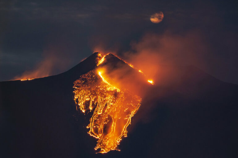
Italy’s Mount Etna has been the focus of many seismic tomography studies, as scientists try to understand the relationship between tectonics and magma pathways beneath Europe’s tallest and most active volcano.
Most subduction zone volcanoes sit above a sinking tectonic plate, and their magma comes from melting in the mantle above sinking tectonic plates. But Etna is located at the collisional zone of the African and European tectonic plates, set within a unique geological environment marked by mountain chains, fault systems, and active tectonics. This peculiar tectonic setting leaves scientists unsure of exactly where Etna’s magma comes from.
For simplicity, many of these seismic tomography studies assume seismic waves will travel through the crust and mantle at the same speed regardless of the direction they travel—that is, they assume these materials are “isotropic.” This technique can offer a rough image of a region’s structure, but it lacks precision, and artifacts in the modeled velocity of seismic waves can be misinterpreted as differences in Earth’s composition or thermal properties.
Anisotropic tomography, on the other hand, considers the directional dependence of the speed of seismic waves, providing more detailed structural information to researchers. R. Lo Bue and colleagues are the first to use P wave anisotropic tomography to peer beneath Mount Etna. (P waves, or primary waves, are the fastest-moving waves in an earthquake.) This imaging offers new insight into the depths of fault segments and sheds light on some of the volcano’s puzzles.
The researchers examined Mount Etna’s record of earthquakes between 2006 and 2016, captured from a network of 30 seismometers. Their data set included earthquakes between magnitude 0.5 and 4.3 with clear P wave records. By including anisotropy in the tomography, they identified fluid magma in the crust and detailed the potential pathways it might take to the surface. The paper is published in the journal Geophysical Research Letters.
In the future, this type of analysis could be a useful tool to improve volcano monitoring because it can reveal information about magma’s movement within the crust and can account for how the orientation of structures such as faults and fractures can affect these paths.
More information:
R. Lo Bue et al, Crustal Structure of Etna Volcano (Italy) From P‐Wave Anisotropic Tomography, Geophysical Research Letters (2024). DOI: 10.1029/2024GL108733

Provided by
American Geophysical Union
This story is republished courtesy of Eos, hosted by the American Geophysical Union. Read the original story here.
Citation:
Improved imaging offers new insight into Mount Etna (2024, July 9)

