Picture an aircraft streaking across the sky at hundreds of miles per hour, unleashing millions of laser pulses into a dense tropical forest. The objective: map thousands of square miles, including the ground beneath the canopy, in fine detail within a matter of days.
Once the stuff of science fiction, aerial lidar – light detection and ranging – is transforming how archaeologists map sites. Some have hailed this mapping technique as a revolutionary survey method.
Yet when used to scan Indigenous lands and ancestral remains, this powerful technology often advances a more troubling, extractive agenda. As an archaeologist who has worked with lidar and collaborated with people who live in areas that have been surveyed from the sky, I’m concerned that this technology can disempower and objectify people, raising an ethical dilemma for the field of archaeology.
The darker side of lidar
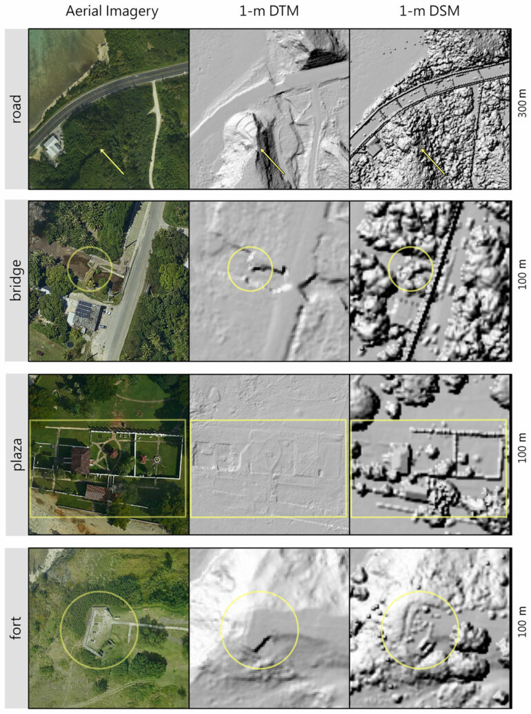
Lidar is a remote sensing technology that uses light to measure distance. Aerial systems work by firing millions of laser pulses per second from an aircraft in motion. For archaeologists, the goal is for enough of those pulses to slip through gaps in the forest canopy, bounce off the ground and return to the laser source with enough energy to measure how far they traveled. Researchers can then use computer programs to analyze the data and create images of the Earth’s surface.

Visualization of surface topography, left, rendered from the aerial lidar scan of Puerto Bello Metzabok in Mexico. The cross-section image, right, is composed of the individual points collected during the aerial scan, which reveal the forest canopy, ground surface and potential archaeological remains.
Christopher Hernandez
The power of this mapping technology has led to a global flurry of research, with some people even calling for the laser mapping of the entire landmass of Earth. Yet, in all the excitement and media buzz, there are important ethical issues that have gone largely unaddressed.
To rapidly map regions in fine detail, researchers need national but not necessarily local permission to carry out an aerial scan. It’s similar to how Google can map your home without your consent.
In archaeology, a point of debate is whether it is acceptable to collect data remotely when researchers are denied access on the ground. War zones are extreme cases, but there are many other reasons researchers might be restricted from setting foot in a particular location.

For example, many Native North Americans do not trust or want archaeologists to study their ancestral remains. The same is true for many Indigenous groups across the globe. In these cases, an aerial laser scan without local or descendant consent becomes a form of surveillance, enabling outsiders to extract artifacts and appropriate other resources, including knowledge about ancestral remains. These harms are not new; Indigenous peoples have long lived with their consequences.
A…

