A recent Colorado State University study published in the journal Geology demonstrates that climate change can affect the frequency of earthquakes, adding to a small but growing body of evidence showing that climate can alter the seismic cycle.
CSU geoscientists analyzed the Sangre de Cristo Mountains in southern Colorado, a range with an active fault along its western edge. Their results indicate that the fault had been held in place under the weight of glaciers during the last ice age, and as the ice melted, slip along the fault increased. This suggests that earthquake activity along a fault could increase as glaciers recede.
“Climate change is happening at a rate that is orders of magnitude faster than we see in the geologic record,” said first author Cece Hurtado, who led the study as her master’s thesis.
“We see this in the rapid mountain glacial retreats in Alaska, the Himalayas and the Alps. In many of these regions, there are also active tectonics, and this work demonstrates that as climate change alters ice and water loads, tectonically active areas might see more frequent fault movements and earthquakes due to rapidly changing stress conditions.”
It is well known that climate adjusts to seismic changes in the Earth’s surface. The tectonic uplift of mountain ranges alters atmospheric circulation and rainfall, for example. However, few studies have investigated climate’s influence on tectonics, and this study is among only a handful linking seismic activity to climate.
“We’ve been able to model these processes for a while, but it’s hard to find examples in nature,” said Sean Gallen, Geosciences associate professor and senior author of the study. “This is compelling evidence. It suggests that the atmosphere and the solid earth have tight connections that we can measure in the field.”
The Sangre de Cristo Mountains were covered with glaciers during the last ice age. Using remote-sensing and field data, the researchers reconstructed where the ice was, calculated the load that would have been pushing on the fault, and then measured displacement of the fault, or how much it had shifted.

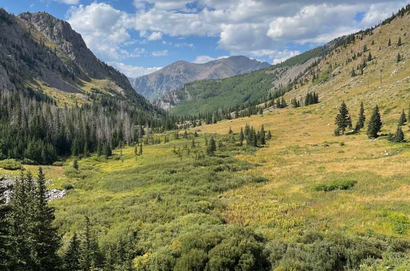
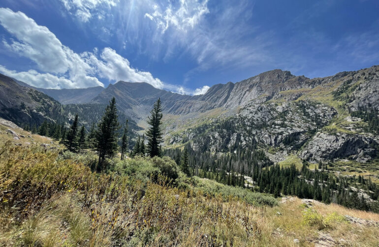
The North Crestone Creek drainage area is an example of the U-shaped valley typical of glacial erosion, as opposed to the V-shaped valleys made by rivers. CSU researchers modeled the extent of ancient glaciers in this basin for the study. © Cece Hurtado
The study found that fault slip rates have been five times faster since the last ice age than during the time the range was covered in glaciers. This research may preview how other glacier-adjacent faults will respond to a warming climate.
Gallen said that the research adds to our understanding of what drives earthquakes, which is important for hazard assessment. Faults in areas with rapidly retreating glaciers or evaporating large bodies of water may need to be monitored for increasing earthquake activity.
The findings are also important to seismologists trying to reconstruct prehistoric seismic records and determine the recurrence intervals of active faults. These hydrologic processes over geologic time should be factored into those calculations, Gallen said.
“This work implies that the repeat time isn’t necessarily going to be periodic,” he added. “You can have periods of time where you have a bunch of earthquakes in quick succession and a lot of time where you don’t have any earthquakes.”
The researchers said that the Sangre de Cristo Mountains were ideal for demonstrating tectonic rebound from melting ice. The range lies along the Rio Grande rift, which has an overall background slip rate they could use as a baseline. Their research uncovered intermittent faster fault slip rates along the range that corresponded with past glaciers. As the glaciers that had been suppressing the fault melted, the slip rate accelerated to catch up to the background rate.
“It’s basically like a small lever that’s tweaking the rate at which the fault moves, but that long-term rate is set by the background rate of the tectonic processes,” Gallen said.
A public database of high-resolution elevation data of the Earth’s surface served as the study’s foundation. Hurtado and Gallen surveyed the fault with high-precision GPS instruments to augment the elevation data and measure fault displacement. Displacement timing was determined based on the age of surrounding sediment deposits.
More information:
Cecilia Hurtado et al, Exploring the impact of deglaciation on fault slip in the Sangre de Cristo Mountains, Colorado, USA, Geology (2024). DOI: 10.1130/G52661.1
Provided by
Colorado State University
Citation:
Climate change could trigger more earthquakes, study suggests (2024, December 19)


