Sea ice coverage in the Arctic Ocean is at one of its lowest levels on record, yet there’s no unanimity on when that ice will disappear completely during summer months.
Understanding the traits and movements of the remaining ice is a persistent challenge for scientists, but a study by researchers at Penn State provides a new tool to explore ice characteristics and interactions along with coastal conditions. Using radar images, fiber-optic sensing and seismic sensors, the team in the College of Earth and Mineral Sciences (EMS) identified different seismic activities linked to the types of ice that are shifting.
The work is published in the journal Geophysical Research Letters.
Drifting sea ice threatens Arctic communities, including infrastructure, as it can crash into stable formations that underpin where people live and work.
The new method can help coastal communities understand the scope, strength and hazards of these ice movements during different seasons, said Tieyuan Zhu, associate professor of geosciences and corresponding author on the study.
“This work creates a foundation to assess threats from particular kinds of sea ice that drift at different times of year,” said Zhu, who is also affiliated with the EMS Energy Institute. “April tends to see smaller but more chunks of ice. In January, they tend to be the strongest.”
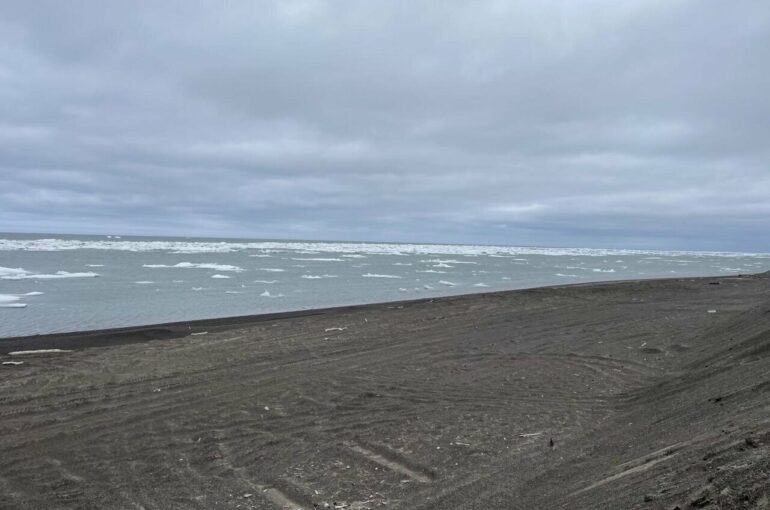
Zhu and Gabriel Rocha Dos Santos, doctoral candidate in geosciences and the first author on the paper, centered their study near Utqiaġvik, a town with a population of about 4,900 in northern Alaska. The region is known informally as the land of fast ice—a reference to landfast ice that attaches to the ground as smaller sea ice travels on wind and ocean currents. The researchers collected seismic and radar data from two large interactions of chunks of sea ice striking landbound, stationary ice—one each on Jan. 4, 2022, and April 8, 2022.
To determine seismic activity during the strikes, the team used data from two mechanisms: broadband seismometers that capture ground motion and fiber-optic cables laid across the tundra. The latter employed acoustics to record longer-distance seismic patterns. Merging the insights with radar-derived visual observations allowed researchers to identify different types of ice-to-ice impacts and associate them with distinct seismic tremors.
The team said they believe those tremors can help reveal traits and threats posed by shifting sea ice where conventional monitoring is limited by harsh Arctic conditions. During the April 2022 event, tremors generated by smaller ice chunks were more intermittent and short-lived despite robust overall ice cover. Three months earlier, when large, more dense ice packs accumulated, the researchers found harmonic tremors, or more constant vibrations.
Zhu described the findings as the first evidence linking types of Arctic ice—and individual ice interactions—to specific seismic signals. Converting the seismic data to audio gave researchers an alternative way to interpret, understand and share the seismic activity in tandem with radar images.
“We could hear the vibration, the tremor,” Dos Santos said. “It’s a very eerie sound when you speed up the recordings to 200 times the ice’s actual rate of movement.”

Gabriel Rocha Dos Santos, left, a Penn State doctoral candidate, and Ahmad Tourei of the Colorado School of Mines fix a cable on Aug. 9, 2022, on the Arctic tundra. They worked inside a tent to protect the cable from wind and dust. © Gabriel Rocha Dos Santos
Accelerating playback helps distinguish variations in ice friction and gliding, which happen over hours-long periods, the researchers said. Some lower-frequency recordings in April 2022 appeared to correlate with lower-velocity movement when drifting and stationary ice had locked up. The more sustained harmonic in January 2022 mirrored larger-mass impacts and the transfer of more ice-to-ice momentum.
Discover the latest in science, tech, and space with over 100,000 subscribers who rely on Phys.org for daily insights.
Sign up for our free newsletter and get updates on breakthroughs,
innovations, and research that matter—daily or weekly.
“Radar images provide useful visuals, but we needed the seismic data to show what’s happening away from the surface, away from the camera lens,” Zhu said.
Merging seismic and radar data serves as a new research tool that can drive future studies to help protect coastal communities, the researchers said. Zhu estimated that Utqiaġvik residents live as close as 100 feet to the coast, leaving them especially vulnerable to erosion and waves created by drifting ice.

“In the context of a rapidly changing Arctic, this multi-sensor approach could help the communities better evaluate immediate hazards as Arctic ice continues to break apart and strike coastal areas, as the drifting ice can be tough to characterize otherwise,” Zhu said.
The new insights can also be useful for residents and those who make their livelihood in the area. Fishermen, for example, depend on sea ice as a fishing platform, so they need to know whether it’s stable, Dos Santos said.
“What we’ve found is very applicable in different regions—in Antarctica, in Greenland, in Russia,” Dos Santos said, explaining that the work would be replicable with similar use of radar images and readily available seismic sensors.
Zhu said that his team, along with other collaborators at Penn State, plan to explore 20 years of prior seismic readings and ice movements in the Arctic region to see how the integrated data assessment approach holds up against the 2022 evaluations in the paper.
More information:
Gabriel Rocha dos Santos et al, Seismic Tremors From Sea‐Landfast Ice Interactions Near Utqiaġvik, Alaska, Geophysical Research Letters (2025). DOI: 10.1029/2025gl117458
Provided by
Pennsylvania State University
Citation:
Decoding dangers of Arctic sea ice with radar, seismic methods and fiber-optic sensing (2025, October 16)

