Coastal dunes are complex and rich areas at the interface between terrestrial and aquatic ecosystems. They are extremely rich in biodiversity and play a crucial role in both environmental and human well-being, such as protecting inland settlements from marine floods.
However, coastal dunes suffer from a phenomenon called “coastal squeeze,” caused by the combined action of sea level rise on one side and urban sprawl on the other. Additionally, other processes such as pollution further undermine their status.
The paper “Enhancing Precision in Coastal Dunes Vegetation Mapping: Ultra-High Resolution Hierarchical Classification at the Individual Plant Level” introduces an innovative method for mapping coastal dune vegetation with unprecedented precision. Co-authored by Melissa Latella, a researcher at the Euro-Mediterranean Center on Climate Change (CMCC), the study presents a novel algorithm that combines drone-acquired ultra-high-resolution multispectral data, field measurements, and machine learning techniques.
The work is published in the International Journal of Remote Sensing.
Preservation of coastal dunes must rely on proper management and planning of conservation activities that, in turn, must be based on monitoring. This research is therefore aimed to provide an innovative method to monitor and map coastal dune vegetation.
 consists of a single plant definition, while LoD2 assigns a class (i.e. species) to the identified segments. © International Journal of Remote Sensing (2024). DOI: 10.1080/01431161.2024.2354135")
Simplified scheme of the adopted LC LoD classification. Level of detail 1 (LoD 1) consists of a single plant definition, while LoD2 assigns a class (i.e. species) to the identified segments. © International Journal of Remote Sensing (2024). DOI: 10.1080/01431161.2024.2354135
This was done through a new classification algorithm that maps vegetation and identifies species at the individual plant level, employing a hierarchical approach with different levels of detail. The algorithm achieved an overall accuracy of 76%, demonstrating its effectiveness and potential for broader application.
The developed algorithm proved to be straightforward and efficient, paving the way to new approaches to coastal monitoring and having the potential to provide data to managers, scientists and modelers.
“Coastal sand dunes are a notable example of the dual necessity of both land cover mapping and plant species identification,” says Latella. “This work set up an algorithm to perform both tasks and address the challenges of classification in these environments. The proposed solution is innovatively based on a hierarchical approach and relies on multitemporal data combining different machine learning techniques.”
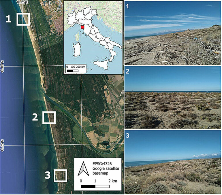
Latella, in collaboration with the Politecnico di Torino (PoliTO), leveraged extensive field data from the Migliarino-San Rossore-Massaciuccoli Regional Park in Italy. The research marks a first in utilizing such data for coastal dune monitoring, setting a benchmark for future studies.

“This paper not only showcases the potential of high-resolution data for environmental conservation but also highlights CMCC’s role in pioneering research that addresses the urgent need for effective coastal dune management,” says Latella. “The findings are poised to inform future conservation efforts, providing valuable insights for environmental managers, scientists, and policymakers.”
More information:
E. Belcore et al, Enhancing precision in coastal dunes vegetation mapping: ultra-high resolution hierarchical classification at the individual plant level, International Journal of Remote Sensing (2024). DOI: 10.1080/01431161.2024.2354135
Provided by
CMCC Foundation – Euro-Mediterranean Center on Climate Change
Citation:
Dunes decoded: A comprehensive and precise mapping for coastal conservation (2024, June 27)

