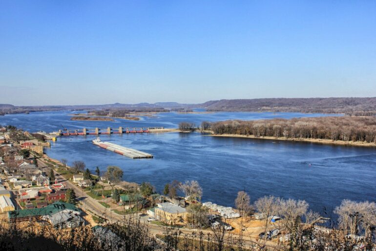
Shifting water levels have driven a significant decline in navigation conditions in recent decades along the Mississippi River, a primary engine of commerce in the United States, research from the federal government and Princeton University shows.
The researchers examined changing water levels along the 2,300-mile waterway from 1963 to 2020 and evaluated the impact on commercial shipping along the river. Low water in the shipping channel sometimes strands traffic in sections of the river, while high water levels have forced operators to close locks and restrict shipping capacity to reflect more difficult conditions for tugs pushing massive collections of river barges.
Although low water often provides more dramatic images, the researchers found that high water levels have had significantly more impact, particularly on sections of the river south of St. Louis. By measuring periods in which authorities imposed navigation restrictions each year, the researchers concluded that the upper Mississippi has lost about 24 good days’ worth of shipping in an average year when comparing conditions at the beginning and end of the study period.
“I was as surprised as everyone else,” said Gabriele Villarini, the corresponding author and a professor of civil and environmental engineering and the High Meadows Environmental Institute at Princeton.
Working with the U.S. Army Corps of Engineers, the federal agency responsible for navigation along the Mississippi, the researchers obtained records from river gauges at 39 locations along the river. The paper, “Reduced and More Fragmented Mississippi River Navigability by Rising Flow,” was published Oct. 10 in Geophysical Review Letters.
The researchers correlated this data with navigation plans the Coast Guard implements for the river based on water conditions and other factors. The researchers analyzed the data to find out whether water levels varied seasonally or over other periods of time, and whether there was a long-term pattern of change that could indicate improvement or decline in river conditions.
It is an important question. The Mississippi is one of the world’s most important waterways, moving goods to and from the Great Lakes and Midwest through the Gulf of Mexico and the Atlantic via the St. Lawrence Seaway.
The researchers said between 2015 and 2019 river traffic carried a yearly average of 400 million tons of goods, peaking at 500 million tons in 2017 and 2018. The Mississippi carries 92% of U.S. agricultural exports and 78% of world exports in feed grain and soybeans. River traffic is extremely efficient—an average 15-barge tow has the same capacity as 1,050 large semi-truck trailers, the researchers said.
To support the traffic, the United States maintains a 9-foot-deep shipping channel from Baton Rouge, Louisiana, to Minneapolis. Oceangoing vessels access a 45-foot-deep channel for ports between New Orleans and Baton Rouge.
The system also includes 28 locks and dams along the main stem of the Upper Mississippi and seven locks along the Illinois River waterway. The Mississippi system also features major rail and highway connections as transit hubs at sites including St. Louis, New Orleans and Chicago.
Villarini said the researchers had noticed recent issues with water conditions on the river in the past few years. In 2022, the Mississippi experienced a significant drought that resulted in news coverage of barges stranded by low water at points in the river. At the same time, high water periods posed their own problems. The Bonnet Carré Spillway upstream of New Orleans, used during high water, was operated eight times between 1931 and 2007; it was operated seven times between 2008 and 2020.
Villarini, then a professor at the University of Iowa, thought the time was right to examine conditions along the Mississippi after a season of low water stranded barges along stretches of the river.
A new graduate student, Renato Amorim, had just joined Villarini’s research team. Before attending graduate school, Amorim worked for the Brazilian government as a specialist in river navigation.
Amorim said that one of the challenges in evaluating conditions along the Mississippi is the regional nature of the river. Not only do conditions vary among different sections, but each section has its own navigational challenges. The Upper Mississippi, with its many locks and bridges, is more often affected by high water levels, while the broad reaches of the Lower Mississippi are often more impacted by low water levels.
Spending time on the river with pilots and tugboat captains, Amorim learned that despite worsening conditions on the river, cargo volumes on the Mississippi have increased in recent decades. He attributed this to the efficiency of the captains and crews, who have adapted to conditions.
This successful adaptation might have cloaked the long-term changes in conditions. Villarini, a hydrologist whose research often focuses on flooding and the impacts of a changing climate, said the researchers took a broad view of the river system to look at long-term changes. Villarini said the researchers were careful not to speculate on the causes of the decline. He said those conclusions will require a more detailed and complex analysis of the region’s hydrology.
He said that without understanding the causes, it will be difficult to propose solutions.
“What does it mean for the next 30 years?” Villarini said. “If we don’t understand the causes, it is very risky to extrapolate trends to the future.”
More information:
R. Amorim et al, Reduced and More Fragmented Mississippi River Navigability by Rising Flow, Geophysical Research Letters (2023). DOI: 10.1029/2023GL104619
Provided by
Princeton University
Citation:
Navigation on the Mississippi has worsened for decades, finds study (2023, November 17)


