O’ahu’s sandy beaches are at risk. New research from the Coastal Research Collaborative (CRC) at the University of Hawai’i (UH) at Mānoa determined that 81% of O’ahu’s coastline could experience erosion by 2100, with 40% of this loss happening by 2030. Importantly, these forecasts of shoreline erosion are more extreme than previous studies indicated for Oʻahu. The study was published recently in Scientific Reports.
“Our findings reiterate the already observed threat of coastal erosion as a hazard to sea level rise in Hawai’i,” said Richelle Moskvichev, geospatial modeler at the CRC in the UH Mānoa School of Ocean and Earth Science and Technology and lead author of the study.
“In rapidly eroding areas, communities may see damage to roads, homes, or underground infrastructure. Shorelines along the north shore and east side of Oʻahu that are backed with hard-armoring, such as seawalls, could experience total beach loss.”
To create erosion predictions, the team of researchers used a computer model that incorporates about thirty years of satellite imagery, as well as aerial and drone imagery. The new model also directly accounts for the seasonal movement of sand. For example, when large swells arrive in the winter on Oʻahu’s north shore, sand is transported from one part of the beach to another.
Given prior modeling efforts, the team’s own survey observations, and anecdotal evidence from residents, the researchers expected to see erosion predicted for many sandy beaches around Oʻahu.
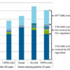
—4 ft (yellow)) of SLR. Locations are labeled by number and common beach name, and oriented with North pointing upwards in every photo except for Kūʻau. Inset of Oʻahu has labels of approximate locations of the example sites. All basemap imagery is from Google Earth (2024), 'Satellite Imagery' layer, accessed September 2024. Outline of Oahu coastline in the inset is provided through the Hawaii Statewide GIS Program, from the 1983 1:24,000 USGS Digital Line Graphs. © Scientific Reports (2025). DOI: 10.1038/s41598-025-95074-y")
Six example sites around Oʻahu with forecasted vegetation line positions for the month of July, under 0.3–1.2 m (1 ft (black)—4 ft (yellow)) of SLR. Locations are labeled by number and common beach name, and oriented with North pointing upwards in every photo except for Kūʻau. Inset of Oʻahu has labels of approximate locations of the example sites. All basemap imagery is from Google Earth (2024), ‘Satellite Imagery’ layer, accessed September 2024. Outline of Oahu coastline in the inset is provided through the Hawaii Statewide GIS Program, from the 1983 1:24,000 USGS Digital Line Graphs. © Scientific Reports (2025). DOI: 10.1038/s41598-025-95074-y
“By including additional satellite data and seasonal modeling, our forecasts show that erosion will increase by nearly 44% above our previous estimates in the short-term, meaning that we anticipate more severe erosion sooner,” said Moskvichev.
Coastal erosion can limit beach access, damage fragile ecosystems and infrastructure, and destroy homes.
“This study provides an update on potential areas of shoreline change around Oʻahu, and can inform long-term development planning for coastal communities and infrastructure of the island,” said Chip Fletcher, interim Dean of SOEST, director of CRC, and senior author of the study.
“This UH-led research provides science-backed data to those who create local adaptation strategies, and ultimately to those most affected by the forecasted hazards. With improved forecasting for erosion hazard zones around the coast, communities, planners, and policymakers can create targeted mitigation and adaptation efforts.”
The research team plans to expand their modeling efforts to the other Hawaiian islands, so that similar predictions are accessible to planners and the communities on all islands. Additionally, they plan to use the results in conjunction with other hazard predictions, such as flooding and groundwater inundation, to analyze overlapping locations and timing of risk to communities.
More information:
Richelle U. Moskvichev et al, Wave driven cross shore and alongshore transport reveal more extreme projections of shoreline change in island environments, Scientific Reports (2025). DOI: 10.1038/s41598-025-95074-y
Provided by
University of Hawaii at Manoa
Citation:
O’ahu’s shores could see heavy erosion by 2030, study finds (2025, April 11)

