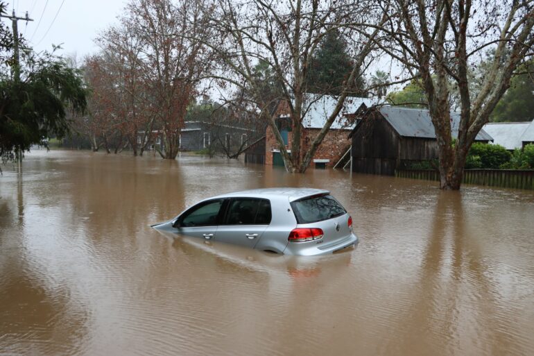
Even today, as California struggles with severe drought, global warming has doubled the likelihood that weather conditions will unleash a deluge as devastating as the Great Flood of 1862, according to a UCLA study released Friday.
In that inundation 160 years ago, 30 consecutive days of rain triggered monster flooding that roared across much of the state and changed the course of the Los Angeles River, relocating its mouth from Venice to Long Beach.
If a similar storm were to happen today, the study says, up to 10 million people would be displaced, major interstate freeways such as Interstates 5 and 80 would be shut down for months, and population centers including Stockton, Fresno and parts of Los Angeles would be submerged—a $1 trillion disaster larger than any in world history.
It would also likely be “bigger in almost every respect” than what scientists have come to call the “ARKStorm scenario” of 1862, said climate scientist Daniel Swain, co-author of the study published Friday in the journal Science Advances.
“There’s more rain overall, more intense rainfall on an hourly basis and stronger wind,” he said.
The paper is the latest piece of research to describe the whiplash effects of a heating planet, where increasing temperatures allow the atmosphere to absorb and store more and more moisture. This atmospheric “thirstiness” can result in either extreme drought and aridity or the massive release of water in the form of an atmospheric river.
The study used a combination of new, high-resolution weather modeling and existing climate models to learn that the risk of a “megaflood” increases as global temperature rises. It also simulated how a long series of storms fueled by atmospheric rivers over the course of a month in the projected climate of 2081-2100 would affect parts of California at the local level. They found that some locations would get more than 100 inches of precipitation.
Atmospheric rivers bring long narrow plumes of concentrated water vapor lifting over the mountains, producing rain and snow.
On 10,000-foot peaks, which would still be somewhat below freezing despite global warming, “you get 20-foot-plus snow accumulations,” Swain said. “But once you get down to South Lake Tahoe level and lower in elevation, it’s all rain.”
Swain and co-author Xingying Huang project that end-of-the-century storms will generate 200% to 400% more runoff in the Sierra Nevada Mountains due to increased precipitation and more precipitation falling as rain, not snow.
The increased runoff could unleash massive landslides and debris flows, particularly in hilly and mountainous areas stripped of vegetation by wildfires.
“Whiplashing shifts” in extreme weather could also challenge the stability of California’s massive collection of aging dams and levees, exposing major cities to inundation.
The study also found that further increases in “megaflood” risk are likely with each additional degree of global warming this century.
The ARKStorm is also known as “the other Big One” after the nickname of an expected major earthquake along the San Andreas Fault.
But unlike an earthquake, an ARKStorm event would result in a disaster zone stretched across thousands of square miles, complicating emergency response efforts and triggering economic and supply chain blockages that would be felt globally.
The researchers are now working collaboratively with the California Department of Water Resources to develop maps pinpointing where flooding could be worst and preparedness strategies to reduce potential losses of lives and property.
Some of their initial proposals, however, are all but certain to generate tensions between flood risk management plans and water conservation projects.
More frequent cycles of droughts and deluges fueled by atmospheric rivers—Pacific-based storms that are hundreds of miles wide—will present both problems and opportunities for West Coast reservoir managers balancing mandates for water storage and flood control, said Alexander Gershunov, a climate scientist at the Scripps Institution for Oceanography in San Diego who is not affiliated with the study.
That’s because, he said, “California will increasingly have to depend on potentially hazardous atmospheric rivers and floodwater for water resource generation in a warming climate.”
Preparing for massive flooding, the UCLA study says, “could mean letting water out of reservoirs preemptively, allowing water to inundate floodplains and diverting water away from population centers.”
Earlier this week, however, Gov. Gavin Newsom called on state agencies to begin preparing for a hotter, drier future with strategies including expansion of water storage and water recycling capacity.
That’s because, he said, new data indicates that California will lose 10% of its water supply by 2040.
“Retaining as much water as we can is a good move,” Swain said, “except that might collide with the necessity to prepare for catastrophic flooding.”
Currently, people are focused on the risk of wildfires, plagues and earthquakes, Swain said. “But catastrophic flooding is a risk that has been rising quietly, but steadily in the background.”
“Eventually, it’s going to come back to bite us,” he said.
More information:
Xingying Huang et al, Climate change is increasing the risk of a California megaflood, Science Advances (2022). DOI: 10.1126/sciadv.abq0995
2022 Los Angeles Times.
Distributed by Tribune Content Agency, LLC.
Citation:
Risk of catastrophic California ‘megaflood’ has doubled due to global warming, researchers say (2022, August 20)


