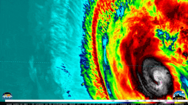
Hurricane season’s most intense period is winding down, but it isn’t quite done with us yet. And the latest storm to watch is whipping things up much farther east than where powerful hurricanes are typically found.
Lorenzo formed as a tropical storm on Sept. 23 in the middle of the Atlantic Ocean, and it reached Category 5 strength on Sept. 28, with winds nearing 160 mph (260 km/h), the National Hurricane Center (NHC) reported. Since the 1920s, 35 Category 5 storms — hurricanes with winds of 157 mph (252 km/h) or higher — have formed in the Atlantic. But Lorenzo is the first hurricane of this strength to appear so far to the east — about 650 miles farther east than Hurricane Hugo, the former record-holder that pummeled the Caribbean with Category 5 winds in 1989, according to the Weather Channel.
Lorenzo, now a Category 2 storm with maximum sustained winds of 105 mph (165 km/h), is barreling toward the Azores — an archipelago that lies 972 miles (1,564 km) off the coast of Portugal — and is expected to make landfall early Wednesday morning, according to an NHC advisory issued today (Sept. 30) at 5 a.m. AST.
NHC hurricane data dating to 1851 show just how much of an outlier Lorenzo is. Most powerful storms that formed in the Atlantic reached their peak strength as they neared the Caribbean Sea and the Gulf of Mexico. But lonely Lorenzo, all alone in the middle of the ocean, is in “a league of its own for this time of year,” climate scientist and FEMA strategic planner Michael Lowry said in a tweet.
With winds of 145 mph, Hurricane #Lorenzo really is in a league of its own for this time of year. pic.twitter.com/PDz6BCt1YKSeptember 27, 2019
“A Category 5…


