A surprising technique has helped scientists observe how Earth’s oceans are changing, and it’s not using specialized robots or artificial intelligence. It’s tagging seals.
Several species of seals live around and on Antarctica and regularly dive more than 100 meters in search of their next meal. These seals are experts at swimming through the vigorous ocean currents that make up the Southern Ocean. Their tolerance for deep waters and ability to navigate rough currents make these adventurous creatures the perfect research assistants to help oceanographers like my colleagues and me study the Southern Ocean.
Seal sensors
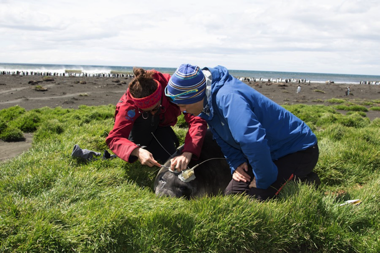
Researchers have been attaching tags to the foreheads of seals for the past two decades to collect data in remote and inaccessible regions. A researcher tags the seal during mating season, when the marine mammal comes to shore to rest, and the tag remains attached to the seal for a year.
A researcher glues the tag to the seal’s head – tagging seals does not affect their behavior. The tag detaches after the seal molts and sheds its fur for a new coat each year.
The tag collects data while the seal dives and transmits its location and the scientific data back to researchers via satellite when the seal surfaces for air.

Scientists attach a tag to a seal after it is safely tranquilized.
Etienne Pauthenet
First proposed in 2003, seal tagging has grown into an international collaboration with rigorous sensor accuracy standards and broad data sharing. Advances in satellite technology now allow scientists to have near-instant access to the data collected by a seal.
New scientific discoveries aided by seals
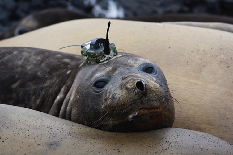
The tags attached to seals typically carry pressure, temperature and salinity sensors, all properties used to assess the ocean’s rising temperatures and changing currents. The sensors also often contain chlorophyll fluorometers, which can provide data about the water’s phytoplankton concentration.

A Weddell seal with a sensor tag.
Christophe Guinet
Phytoplankton are tiny organisms that form the base of the oceanic food web. Their presence often means that animals such as fish and seals are around.
The seal sensors can also tell researchers about the effects of climate change around Antarctica. Approximately 150 billion tons of ice melts from Antarctica every year, contributing to global sea-level rise. This melting is driven by warm water carried to the ice shelves by oceanic currents.
With the data collected by seals, oceanographers have described some of the physical pathways this warm water travels to reach ice shelves and how currents transport the resulting melted ice away from glaciers.
Seals regularly dive under sea ice and near glacier ice shelves. These regions are challenging, and can even be dangerous, to sample with traditional oceanographic methods.


