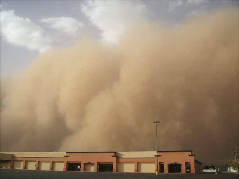
Windstorms can seem like they come out of nowhere, hitting with a sudden blast. They might be hundreds of miles long, stretching over several states, or just in your neighborhood.
But they all have one thing in common: a change in air pressure.
Just like air rushing out of your car tire when the valve is open, air in the atmosphere is forced from areas of high pressure to areas of low pressure.
The stronger the difference in pressure, the stronger the winds that will ultimately result.
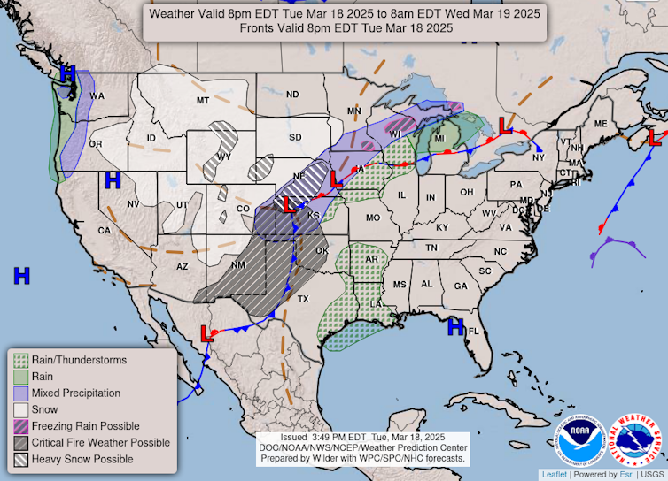
On this forecast for March 18, 2025, from the National Oceanic and Atmospheric Administration, ‘L’ represents low-pressure systems. The shaded area over New Mexico and west Texas represents strong winds and low humidity that combine to raise the risk of wildfires.
NOAA Weather Prediction Center
Other forces related to the Earth’s rotation, friction and gravity can also alter the speed and direction of winds. But it all starts with this change in pressure over a distance – what meteorologists like me call a pressure gradient.
So how do we get pressure gradients?
Strong pressure gradients ultimately owe their existence to the simple fact that the Earth is round and rotates.
Because the Earth is round, the sun is more directly overhead during the day at the equator than at the poles. This means more energy reaches the surface of the Earth near the equator. And that causes the lower part of the atmosphere, where weather occurs, to be both warmer and have higher pressure on average than the poles.
Nature doesn’t like imbalances. As a result of this temperature difference, strong winds develop at high altitudes over midlatitude locations, like the continental U.S. This is the jet stream, and even though it’s several miles up in the atmosphere, it has a big impact on the winds we feel at the surface.
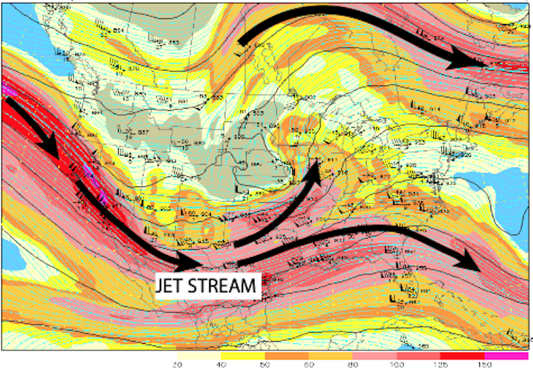

Wind speed and direction in the upper atmosphere on March 14, 2025, show waves in the jet stream. Downstream of a trough in this wave, winds diverge and low pressure can form near the surface.
NCAR
Because Earth rotates, these upper-altitude winds blow from west to east. Waves in the jet stream – a consequence of Earth’s rotation and variations in the surface land, terrain and oceans – can cause air to diverge, or spread out, at certain points. As the air spreads out, the number of air molecules in a column decreases, ultimately reducing the air pressure at Earth’s surface.
The pressure can drop quite dramatically over a few days or even just a few hours, leading to the birth of a low-pressure system – what meteorologists call an extratropical cyclone.
The opposite chain of events, with air converging at other locations, can form high pressure at the surface.
In between these low-pressure and high-pressure systems is a strong change in pressure over a distance – a pressure gradient. And that pressure gradient leads to strong winds. Earth’s rotation

