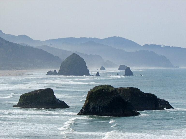
On Jan. 16, 2016, beachgoers up and down the Washington, Oregon and northern California coasts were surprised by multiple “sneaker” waves that inundated beaches, caused injuries and swamped a vehicle.
Sneaker waves, also known as wave runup events, can be perceived as a mini-tsunami because the waves surge much farther up the beach than anticipated, often catching beachgoers unaware. The rapid and forceful surge from a sneaker wave can sweep beachgoers off their feet, trap them against jetties or rocky shorelines, push logs and other heavy debris into them and pull them into the ocean when the wave rushes back down the beach, all while exposing them to dangerously cold water.
The Jan. 16, 2016, events occurred over a five-hour period on beaches from Humboldt Bay, California, to Pacific Beach, Washington. They were likely fueled by a specific type of wave condition generated by far-off storms and paired with just the right conditions closer to shore, a new study by Oregon State University researchers has found.
The paper is published in the journal Natural Hazards and Earth System Sciences.
The finding is an important step in understanding the causes of sneaker waves and developing a system for predicting such waves, which could improve warning systems and help reduce deaths and injuries, said Tuba Özkan-Haller, interim dean of OSU’s College of Earth, Ocean, and Atmospheric Sciences and a co-author of the study.
Across Oregon, Washington and northern California, extreme runup events contribute to about two drowning deaths each year.
“There are some things that are predictable about sneaker waves—we know they are more likely to occur in winter months, and that they are likely to occur in parts of the world where the continental shelf is narrow, such as the Pacific Northwest,” said Özkan-Haller, an oceanography professor who studies the physics of ocean waves.
The National Weather Service issues sneaker wave warnings based on those elements of predictability, but such warnings could be improved as researchers learn more about how the waves are created, she said.
“The more we learn, the closer we get to our ultimate goal, which would be to develop a warning system that is specific, accurate and localized,” Özkan-Haller said.
The study’s lead author is Chuan Li, who conducted the research as a doctoral student at Oregon State. Li completed his Ph.D. in 2021 and continued doing runup-related studies as a postdoctoral researcher at UCLA. He now works in Hong Kong as a senior engineer at Arup.
Additional authors are Robert Holman and Peter Ruggiero of OSU’s College of Earth, Ocean, and Atmospheric Sciences; Gabriel Garcia-Medina of the Pacific Northwest National Laboratory, who also earned a doctorate at OSU; and Treena Jensen, David Elson and William R. Schneider of the National Weather Service in Portland.
“Close collaboration with the scientists and forecasters at the National Weather Service was a key component in helping us home in on the relationship between the offshore wave climate and the potential for sneaker waves,” Özkan-Haller said.
The sneaker waves that occurred Jan. 16, 2016, caught researchers’ attention in part because there were several events up and down the coast during a short period of time, and because multiple videos of the events were posted on YouTube.
Özkan-Haller, Li and their colleagues used the videos and other available scientific data such as wave height readings and wind speeds to test several theories around what may have caused the series of sneaker waves that day.
“The videos showed important general characteristics of the extreme runup events on this day—in particular that they were roughly 5 minutes from beginning to end,” said Li. “This information helped us identify their signals from tide gauges and also helped narrow down possible causes.”
The researchers found a relationship between two types of waves: surface gravity waves, which surfers watch and surf, and which arrive in sets and break on the beach; and underlying longer “infragravity” waves, which are longer waves fed by the energy created by gravity waves. One infragravity wave will run underneath a set of gravity waves.
When large storms are brewing near Alaska or the South Pacific, they can create conditions where there is more time between each wave in a set of gravity waves—the waves are spaced out over a longer period of time, and the wave field looks well-organized. Those conditions also make the underlying infragravity waves longer and stronger.
“The longer the wave is, the less likely it is to break,” Özkan-Haller said. “Instead, it sloshes up, like the water would if you’re getting into a bathtub.”
These longer waves also carry more energy, so they can run a lot further up the beach. But not all of these long waves turn into sneaker waves; other conditions, including weather near the shore, also factor in.
“If these long waves are forming out in the ocean, but there is also a local storm, the wave field is jumbled, and sneaker waves won’t occur,” Özkan-Haller said. “When the wind is calm, the local weather is mild—a beautiful day on the beach—sneaker waves are more likely.”
Not all coastlines are vulnerable to sneaker waves; the narrow continental shelf and the potential for far offshore winter storms contribute to their occurrence in the Pacific Northwest. More research is needed to understand why certain locations within the region are more prone than others to sneaker waves, according to Özkan-Haller.
Until researchers are able to generate accurate and localized forecasts, Özkan-Haller suggests a few safety tips for beachgoers:
Check the National Weather Service social media outlets for sneaker wave warnings.Before heading down to the beach, spend some time—20 minutes—watching the waves from a nearby viewpoint. Count the seconds between each wave breaking on the shore. The more time between waves, the more likely a sneaker wave could occur. If the waves are 20 or more seconds apart and look well-organized, with long, clean lines of swell waves, be especially cautious.Avoid areas where you could be trapped by rushing water, such as jetties or rocky cliffs, and areas where rolling logs could be swept up and into you.Don’t turn your back on the ocean, and always have an exit plan that will get you to higher ground in 15 to 30 seconds.
“The worst position you can put yourself in is to get trapped—pushed up against a dune or rocks or perched on a jetty at the mercy of the down rush or overtopping waves without an exit path,” Özkan-Haller said. “It never hurts to be extra vigilant about watching the ocean and making sure one has an exit plan. One sneaker wave can change the course of life.”
More information:
Chuan Li et al, Observations of extreme wave runup events on the US Pacific Northwest coast, Natural Hazards and Earth System Sciences (2023). DOI: 10.5194/nhess-23-107-2023
Provided by
Oregon State University
Citation:
Far-off storms fuel dangerous ‘sneaker’ waves along Pacific Northwest coast, new research suggests (2023, January 31)


