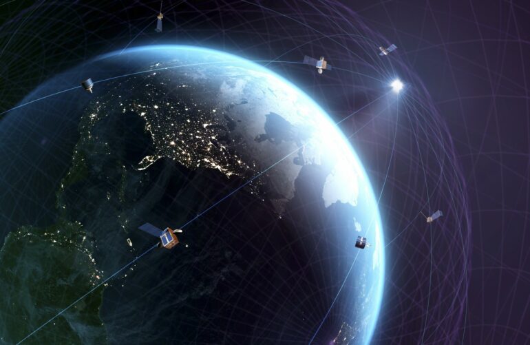
Researchers have developed an algorithm that can “eavesdrop” on any signal from a satellite and use it to locate any point on Earth, much like GPS. The study represents the first time an algorithm was able to exploit signals broadcast by multi-constellation low Earth orbit satellite (LEO) satellites, namely Starlink, OneWeb, Orbcomm and Iridium.
Researchers found that by listening to the signals of eight LEO satellites for about 10 minutes, their algorithm could achieve unprecedented accuracy in locating a stationary receiver on the ground and was able to converge on it with an error of only about 5.8 meters.
The research, led by Zak Kassas, a professor of electrical and computer engineering at The Ohio State University and director of the Department of Transportation Center for Automated Vehicles Research with Multimodal AssurEd Navigation (CARMEN), was presented last week at the IEEE/ION Position Location and Navigation Symposium (PLANS) 2023 conference in Monterey, California. Along with Ohio State Ph.D. students Sharbel Kozhaya and Haitham Kanj, the paper, which demonstrated the first ever exploitation of unknown OneWeb LEO satellite signals, won the conference’s Best Student Paper award.
The researchers did not need assistance from the satellite operators to use the signals, and they emphasized that they had no access to the actual data being sent through the satellites—only to publicly available information related to the satellites’ downlink transmission frequency and a rough estimate of the satellites’ location.
From transportation to communication systems to the power grid and emergency services, nearly every aspect of modern society relies on positioning, navigation and timing data from global navigation satellite systems (GNSS), or GPS, that orbit the Earth. Despite this, because GPS system signals are weak and susceptible to interference, they can often become unreliable in certain places such as indoor environments or in deep urban canyons. In addition, GNSS signals are spoofable, which poses serious security risks in safety-critical applications, such as aviation.
In the long term, such complications could lead to a number of navigational and cybersecurity issues, especially as virtually all of our current systems rely heavily on GPS, Kassas said. Technologies on the rise, such as autonomous vehicles, he noted, are beginning to amplify the limitations of our current GNSS systems.
“It’s becoming more pressing to find civilian and military alternatives to GPS, whether as a backup or in the case when GPS isn’t there whatsoever,” said Kassas.
This study builds on previous research by Kassas’ lab that solely used six SpaceX satellite signals to pinpoint a location within 10 meters of accuracy, which was recently reduced to 6.5 meters.
“The Starlink study scratched the surface of what is possible,” said Kassas.
His work suggests utilizing signals from LEO satellites as an alternative for humans’ positioning, navigation and timing needs, as they reside about 20 times closer to Earth compared to GNSS satellites, which reside in medium Earth orbit—a little more than 20,000 kilometers above the planet. According to Kassas, the technology could potentially usher in a new era of positioning, navigation and timing.
“We are witnessing a space renaissance. Tens of thousands of LEO satellites will be launched into space over the next decade, leading to what is referred to as mega-constellations,” he said. “Signals transmitted by these satellites will revolutionize numerous technologies and benefit scientific inquiry in fields such as remote sensing.”
What also makes the study so different from all other attempts at creating an alternative to GPS is, unlike previous studies, this algorithm doesn’t reverse engineer the signal, said Kassas.
“Our algorithm is agnostic to the LEO constellation,” said Kassas. “Our receiver can listen to virtually any satellite signal, trains on the data it’s receiving on-the-fly, then deciphers certain features of the signal in a way where we can reconstruct what they are transmitting into location data.” To demonstrate the team’s new approach, the team applied the algorithm to four different LEO satellite constellations: Starlink, OneWeb, Orbcomm and Iridium. The algorithm cracked all these signals, with virtually no prior knowledge about what is being transmitted.
Additionally, their algorithm is so sophisticated that the researchers were also able to estimate where the satellites are in space. In order to use the satellite to position ourselves, we need to know where the satellite is located. “That’s a very challenging problem because LEO satellites don’t normally broadcast their location, and our publicly available estimates of where they are is off by a few kilometers,” said Kassas.
During a stationary experiment to test how the signals worked as an accurate positioning system, researchers set a ground receiver’s initial position estimate to the roof of an engineering parking structure at the University of California, Irvine, a spot more than 2,000 miles away from its actual position: the roof of Ohio State’s Electroscience Laboratory (ESL) in Columbus, Ohio. Using the satellite constellations to guess where exactly in the country the receiver actually was, the algorithm was only off by about 5 meters.

In another experiment, the researchers tested how the algorithm would fare on a moving vehicle, and mounted the receiver onto the top of a car. First, they used today’s navigation technology, which relies on a GPS receiver coupled with an inertial navigation system (INS). They navigated for about 100 meters before cutting GPS off, after which they drove for nearly a kilometer. They found that by relying on today’s GPS-INS system, they were said to be located about 500 meters away from their true location, but with their algorithm, they were found about 4.4 meters away. “Our result showed that our system is getting close to what you can do with GPS today,” said Kassas.
Although a patent has been filed on the algorithm, the team does plan to continue evolving all of the algorithm’s technical abilities, said Kassas.
“GPS is a very mature system that we trust with our lives,” he said. “To be able to trust new types of signals with our lives, there will have to be more studies on their accuracy, integrity and continuity.”
More information:
Paper: Multi-Constellation Blind Beacon Estimation, Doppler Tracking, and Opportunistic Positioning with OneWeb, Starlink, Iridium NEXT, and Orbcomm LEO Satellites
Provided by
The Ohio State University
Citation:
This algorithm can make satellite signals act like GPS (2023, May 5)

