Prepare for some dark and stormy nights (and days).
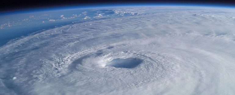
This year’s Atlantic hurricane season, which begins June 1 and lasts until November 30, will bring another wave of higher- than-average storm formation, following in the footsteps of 2020’s record-shattering season, according to the latest forecast by the National Oceanic and Atmospheric Administration (NOAA).
On Thursday (May 20), NOAA scientists predicted that we are most likely to see “above normal” hurricane activity, with a 70 percent probability of 13 to 20 named storms. Of those, six to 10 will become hurricanes and as many as five could strengthen into major hurricanes, with winds reaching at least 179 km/h (111 mph).
Better technology for storm detection and for understanding storm structure has also led NOAA experts to recalibrate their standards for what an “average” hurricane season looks like – and that average is now higher than it used to be, according to Matthew Rosencrans, hurricane season outlook lead for NOAA’s Climate Prediction Center.
Previously, based on data from 1981 to 2010, 12 named storms was the average per season, with six storms becoming hurricanes and three classified as major hurricanes – those reaching Category 3, 4 or 5 in strength.
But from now on, NOAA’s Climate Prediction Center (CPC) will look at storm activity using a dataset from a new 30-year period: 1991 to 2020.
The new average number of storms is 14, with seven of those expected to become hurricanes, Rosencrans said at the NOAA briefing. (The average number of major hurricanes – three – remains the same.)
This shift reflects not only improved storm detection, but also higher levels of storm activity over the past three decades. One explanation for this could be the presence of a a positive Atlantic Multi-decadal Oscillation – a cyclical variation in sea surface temperature that is currently in a warmer-than-average stage, which can increase Atlantic hurricane activity, NOAA says.
Colorado State University’s (CSU) Tropical Weather and Climate Research team released their predictions for the 2021 Atlantic hurricane season on April 8, forecasting 17 named storms, 8 hurricanes and 4 major hurricanes.
But regardless of how many hurricanes are predicted, “it only takes one hurricane making landfall” to make it an active season for coastal residents, according to CSU.
“They should prepare the same for every season, regardless of how much activity is predicted,” CSU says.
Records show that stronger, wetter storms are becoming more frequent, and a growing body of evidence suggests that climate change is driving this shift.
Wind speeds in hurricanes that pummel Bermuda are more than twice as strong as they were sixty years ago, and they’re drawing their destructive power from warming oceans, Live Science reported in March.
Analysis of 4,000 tropical cyclones spanning four decades showed that such storms are forming more often and increasing in strength as global temperatures rise. Researchers’ models have also shown that hurricanes during the past decade flooded coastal areas with 10 percent more rainfall due to climate change – and that number could rise to 30 percent before the end of the century.
Below average in the Central Pacific
Unlike the Atlantic hurricane season, the Central Pacific is expected to see average or even below-average storm formation, with only two to five tropical cyclones emerging (a typical season produces at least four cyclones), NOAA reported on May 19.
Experts anticipate less activity this year because ocean temperatures are cooler than usual in the central and eastern tropical Pacific Ocean where hurricanes form, “and because El Niño is not present to increase the activity,” Rosencrans said in the statement.
The Central Pacific hurricane season also lasts from June 1 to November 30, according to NOAA.
Weather and climate researchers at the United Kingdom’s national weather service – the Meteorological Office, or Met Office – expect an average hurricane season for the North Atlantic, predicting 14 named storms, seven hurricanes and three major hurricanes, in a forecast published on Thursday (May 20).
Last year, an extremely active 2020 Atlantic hurricane season broke records with 30 named storms, 12 of which made landfall in the continental United States (five of these slammed into Louisiana).
The season started early, with nine named storms forming between May and July, and by September the National Hurricane Center (NHC) had used up its list of 21 Atlantic hurricane names and began naming storms after Greek letters, according to NOAA.
Prior to 2020, the most active Atlantic hurricane season was in 2005, with 28 named storms. That year marked the first time that the NHC used up its list of names and had to resort to Greek letters, Live Science previously reported.
The first of the 21 hurricane names on this year’s NHC list is ‘Ana’, followed by ‘Bill’, ‘Claudette’, ‘Danny’ and ‘Elsa’. However, it remains to be seen if there will be so many hurricanes that the NHC will require names beyond the last one on the list: ‘Wanda’.
A history of destruction: 8 great hurricanes
How hurricanes work (infographic)
The 20 costliest, most destructive hurricanes to hit the US
This article was originally published by Live Science. Read the original article here.


