Being able to withstand hurricane-force winds is the key to a long life for many buildings on the Eastern Seaboard and Gulf Coast of the U.S. Determining the right level of winds to design for is tricky business, but support from artificial intelligence may offer a simple solution.
Equipped with 100 years of hurricane data and modern AI techniques, researchers at the National Institute of Standards and Technology (NIST) have devised a new method of digitally simulating hurricanes. The results of a study published today in Artificial Intelligence for the Earth Systems demonstrate that the simulations can accurately represent the trajectory and wind speeds of a collection of actual storms. The authors suggest that simulating numerous realistic hurricanes with the new approach can help to develop improved guidelines for the design of buildings in hurricane-prone regions.
State and local laws that regulate building design and construction—more commonly known as building codes—point designers to standardized maps. On these maps, engineers can find the level of wind their structure must be able to handle based on its location and its relative importance (i.e., the bar is higher for a hospital than for a self-storage facility). The wind speeds in the maps are derived from scores of hypothetical hurricanes simulated by computer models, which are themselves based on real-life hurricane records.
“Imagine you had a second Earth, or a thousand Earths, where you could observe hurricanes for 100 years and see where they hit on the coast, how intense they are. Those simulated storms, if they behave like real hurricanes, can be used to create the data in the maps almost directly,” said NIST mathematical statistician Adam Pintar, a study co-author.
The researchers who developed the latest maps did so by simulating the complex inner workings of hurricanes, which are influenced by physical parameters such as sea surface temperatures and the Earth’s surface roughness. However, the requisite data on these specific factors is not always readily available.
More than a decade later, advances in AI-based tools and years of additional hurricane records have made an unprecedented approach possible, which could result in more realistic hurricane wind maps down the road.
NIST postdoctoral researcher Rikhi Bose, together with Pintar and NIST Fellow Emil Simiu, used these new techniques and resources to tackle the issue from a different angle. Rather than having their model mathematically build a storm from the ground up, the authors of the new study taught it to mimic actual hurricane data with machine learning, Pintar said.
Studying for a physics exam by only looking at the questions and answers of previous assignments may not play out in a student’s favor, but for powerful AI-based techniques, this type of approach could be worthwhile.
With enough quality information to study, machine-learning algorithms can construct models based on patterns they uncover within datasets that other methods may miss. Those models can then simulate specific behaviors, such as the wind strength and movement of a hurricane.
In the new research, the study material came in the form of the National Hurricane Center’s Atlantic Hurricane Database (HURDAT2), which contains information about hurricanes going back more than 100 years, such as the coordinates of their paths and windspeeds.
The researchers split data on more than 1,500 storms into sets for training and testing their model. When challenged with concurrently simulating the trajectory and wind of historical storms it had not seen before, the model scored highly.
“It performs very well. Depending on where you’re looking at along the coast, it would be quite difficult to identify a simulated hurricane from a real one, honestly,” Pintar said.
They also used the model to generate sets of 100 years’ worth of hypothetical storms. It produced the simulations in a matter of seconds, and the authors saw a large degree of overlap with the general behavior of the HURDAT2 storms, suggesting that their model could rapidly produce collections of realistic storms.
However, there were some discrepancies, such as in the Northeastern coastal states. In these regions, HURDAT2 data was sparse, and thus the model generated less realistic storms.
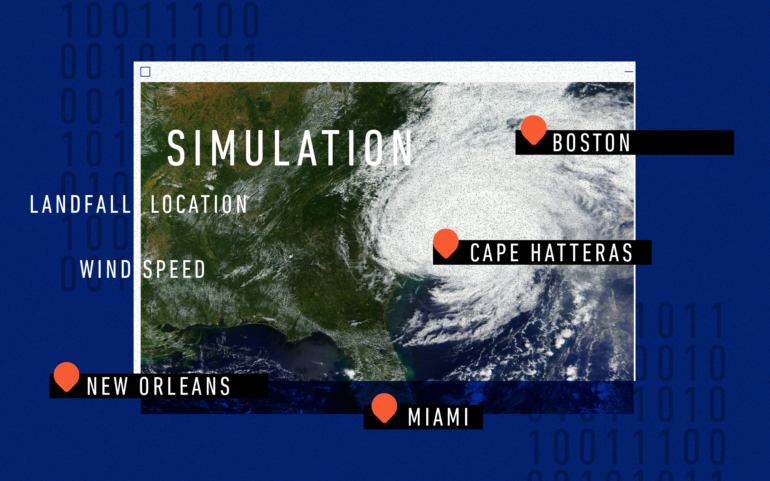
“Hurricanes are not as frequent in, say, Boston as in Miami, for example. The less data you have, the larger the uncertainty of your predictions,” Simiu said.
As a next step, the team plans to use simulated hurricanes to develop coastal maps of extreme wind speeds as well as quantify uncertainty in those estimated speeds.

Since the model’s understanding of storms is limited to historical data for now, it cannot simulate the effects that climate change will have on storms of the future. The traditional approach of simulating storms from the ground up is better suited to that task. However, in the short term, the authors are confident that wind maps based on their model—which is less reliant on elusive physical parameters than other models are—would better reflect reality.
Within the next several years they aim to produce and propose new maps for inclusion in building standards and codes.
More information:
Rikhi Bose et al, Simulation of Atlantic Hurricane Tracks and Features: A Coupled Machine Learning Approach, Artificial Intelligence for the Earth Systems (2023). DOI: 10.1175/AIES-D-22-0060.1
Provided by
National Institute of Standards and Technology
This story is republished courtesy of NIST. Read the original story here.
Citation:
AI could set a new bar for designing hurricane-resistant buildings (2023, March 29)

