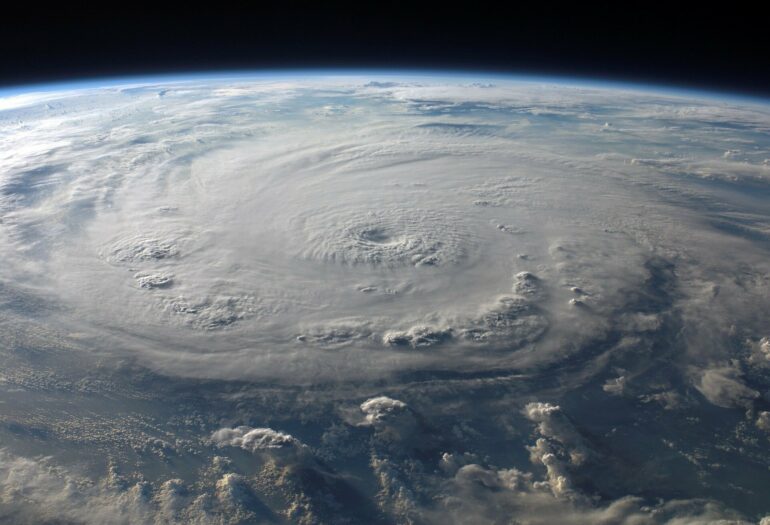
Extreme flooding events spawned by hurricanes are likely to become far more frequent along the Eastern and Southern U.S. coastlines because of a combination of sea level rise and storm intensification. The findings, contained in new research from Princeton University, show that the two sources of water can produce what researchers call compound flooding events, with impact much worse than those from surge or rainfall alone.
The study, in the journal Nature Climate Change, is among the first to assess how climate change could impact the frequency of extreme rainfall-surge events. The researchers hope the findings will help better inform policymakers as well as bolster overall preparedness for the severe storms to come.
“Most studies have looked at the hazards of rainfall and storm surge separately, but in this study, we looked at the joint hazards from the Gulf Coast up through New England,” said Ning Lin, an associate professor of civil and environmental engineering at Princeton and senior author of the study appearing online on Feb. 3.
Two graduate students in Lin’s lab, Avantika Gori and Dazhi Xi, are coauthors of the paper, along with Lin’s longtime collaborator Kerry Emanuel, a professor of meteorology at the Massachusetts Institute of Technology.
Using physics-based climate and hurricane hazard models and statistical analyses, the new study projects a dramatic rise in how often joint 100-year events—that is, events with a 1% chance to happen in any given year for both rainfall and storm surge in the historical period—will occur by the year 2100.
Along the Gulf of Mexico, extreme rainfall-surge events have historically occurred on average every 200-500 years. But by the end of the 21st century, according to the study’s findings, these extreme events may occur on average every 10-30 years. The outlook is even direr in New England, where extreme joint events are rare in the historical climate, happening on average less than once in a thousand years. However, by the end of the century, these calamitous events may occur on average once every five years.
To arrive at these projections, the research team started with eight different global climate models—mathematically complex, data-rich simulations of how the world’s climate is being altered due to greenhouse gas levels in the atmosphere. The researchers then downscaled these models to generate tens of thousands of synthetic storms for the region of interest along the western Atlantic and the Gulf of Mexico. A reliable averaging of the models, which weigh climate component variables in different ways, was obtained by comparing their predictions of past hurricane development and strength to historical simulations. “This way, by comparing the models’ predictions of the past, we know we have a reasonable basis for the models’ predictions of the future,” said Lin.
The researchers next built out models of the powerful winds produced by the hurricanes and how far the winds extend outward from the storm. Those powerful winds drive storm surges by pushing great volumes of water toward land. The storm winds also play a role in their simulation of storm’s rainfall. In addition to wind intensity, storm translation speed, or how fast it moves over land and water, also affect rainfall and storm surges. Slower storm translation speeds lead to greater rainfall as the storm spends more time dumping precipitation over an area. In an indication of their intertwinement as joint hazards, increased rainfall can add to the local storm surge flooding, while slower storms may give gale-force winds more time to pile up higher, more damaging surges.
The analysis enabled the researchers to gauge the relative contributions of sea level rise and storm changes—effects that have both been well-documented over the last decade—to the joint rainfall-surge hazards. Sea level rise has long been thought of as a primary driver of more frequent floods, given the dramatic increase over the last thirty years of around 0.13 inches per year. For the eastern seaboard of the U.S., though, the new study implicates increasing storm intensity and slowing translation speeds as the main reasons why joint extreme rainfall-surge events look set to spike. “It’s a surprising finding that says we should not neglect changes in storm climatology, with enhanced rainfall projected to play a bigger and bigger role in driving compound flooding,” said Lin.
Thomas Wahl, an assistant professor at the University of Central Florida who was not involved in the study, offered comments on its significance.
“Based on the results presented in this study and others,” said Wahl, “it is paramount for decision-makers to properly account for compound flooding events in their coastal management and adaptation plans.”
Wahl noted that the U.S. Army Corps of Engineers and the Federal Emergency Management Agency (FEMA), two agencies deeply involved in flood mitigation and disaster response, have both recently created task forces to better understand the impacts of compound flooding.

This growing awareness of the threat of compound flooding dovetails with Lin’s own work on hurricane risk analysis, where the hazards of storm surge and rainfall are no longer being treated as separate phenomena. “We’ve been learning that as joint hazards, surge and rainfall really should be studied together, and right now that’s where my work is going,” said Lin. “The current and future joint hazard posed by hurricanes has not been well-quantified, but with this study, we’re now getting a clearer, and unfortunately sobering picture.”
More information:
Ning Lin, Tropical cyclone climatology change greatly exacerbates US extreme rainfall–surge hazard, Nature Climate Change (2022). DOI: 10.1038/s41558-021-01272-7. www.nature.com/articles/s41558-021-01272-7
Provided by
Princeton University
Citation:
Future hurricanes likely to pose much greater flood risk to US East and Gulf coasts (2022, February 3)

